Tag Archives: lithic

More Clothes From The Future Available Today- A Jacket Made From Stone

We’ve built new material technologies out of wood, metals and mycelium. Creating a Rock Jacket would be our greatest challenge, a 3-million-year-old problem.


Vollebak Logo
The Rock Jacket | vollebak.com
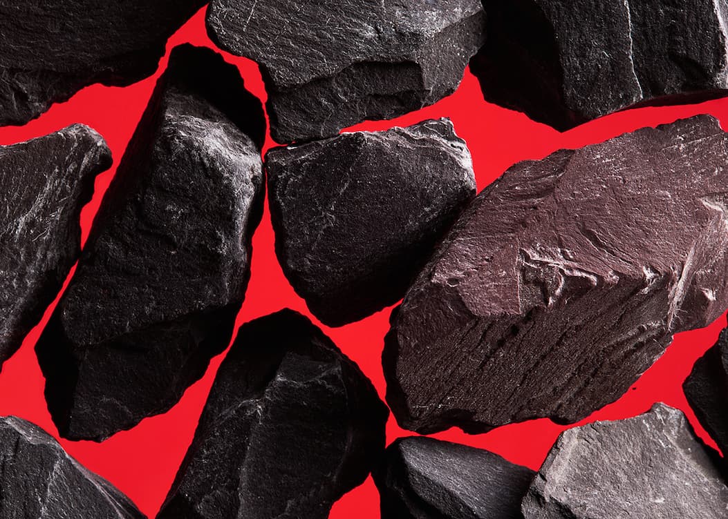
Rock has been our most important technology. It made us apex predators. We used it to build cities and empires. Now we’ve worked out how to wear it. Welcome back to the Stone Age.
The Rock Jacket | vollebak.com
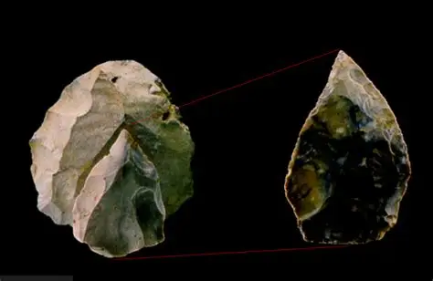
Around 3.3 million years ago, on the shores of Lake Turkana in Kenya, one of our ancestors bashed together two rocks and knocked off a short, sharp flake. It’s the oldest tool we’ve ever found, and it long predates fire, clothing and language.For almost all of prehistory, rock was our cutting edge.

Stone blades and hammerstones meant we could hunt, tear and scrape meat and marrow. And the calories they provided built bigger brains. So we started to think bigger. And taller. By 8000 BCE Jericho was ringed by a stone wall. Stonehenge, the pyramids, the Parthenon and the Pantheon followed. Rock is how we held territory, honoured our gods and told the future we’d been here.

But in more than 3 million years of making good use of rock, we’ve never managed to wear it. Rock is brilliant at not moving. And clothes have to move all the time.We’ve built new material technologies out of wood, metals and mycelium. Creating a Rock Jacket would be our greatest challenge, a 3-million-year-old problem.
The Rock Jacket | vollebak.com

Woowood. stevenleprize.com

We found part of the solution in Paris. Steven Leprizé is a French designer, material technologist and experimental cabinetmaker. He makes wood that inflates, bends and bonds with metal.Hermès used one of his materials for its KellyWood bag.
Jony Ive commissioned him to make bespoke furniture for his yacht.
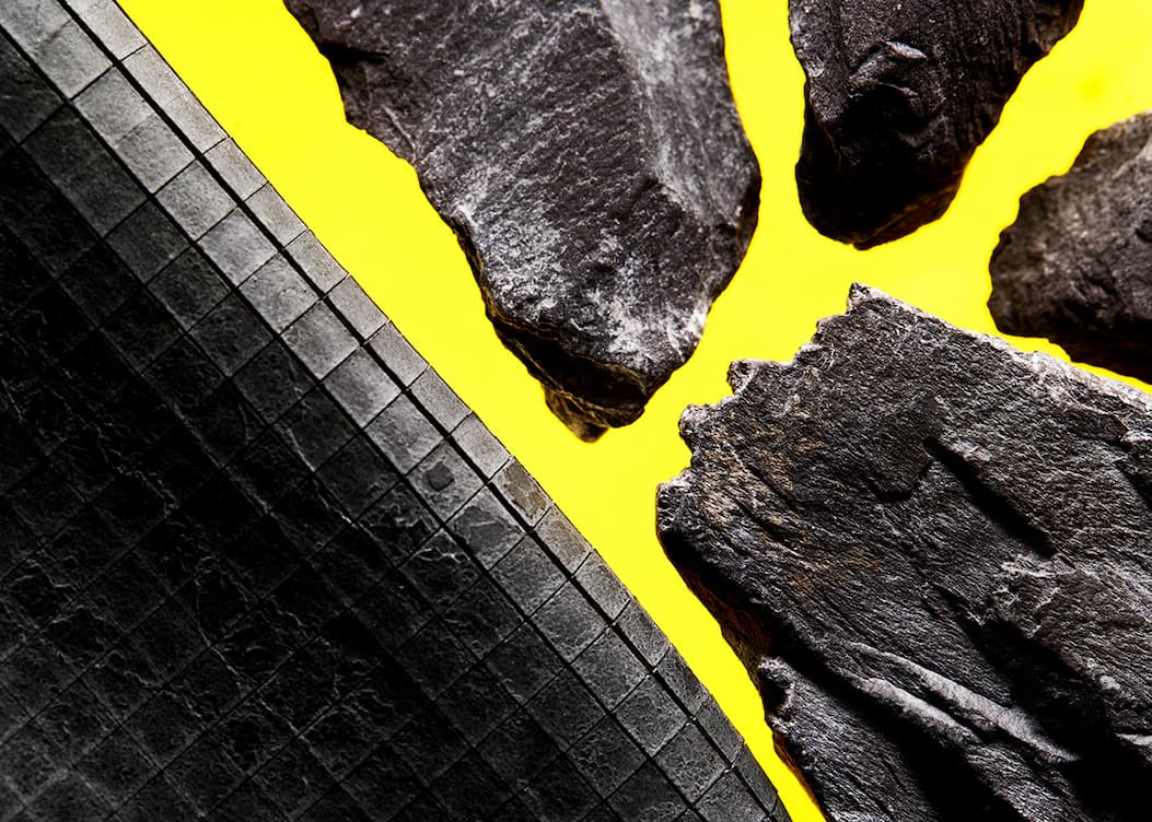
He’d taken WooWood, his elastic marquetry of tiny wood tiles backed with rubber, and made a version in slate.
Slate splits along its layers, so it can be peeled incredibly thin. The sheets Leprizé uses arrive at 100cm x 50cm and just 0.5mm thick. Cutting them into perfectly clean 5mm x 5mm squares isn’t easy.
“There are 50 steps to making this material,” says Leprizé, “and the cutting of the tiles is the most important.” Each slice of slate has its own topography of contour lines, peaks and valleys. Preserving that flattened landscape means not losing a single tile.
The Rock Jacket | vollebak.com
“There are 50 steps to making this material,” says Leprizé, “and the cutting of the tiles is the most important.” Each slice of slate has its own topography of contour lines, peaks and valleys. Preserving that flattened landscape means not losing a single tile.
The Rock Jacket | vollebak.com
The tiles are then glued under pressure to a thin neoprene backing, using a technique Leprizé developed with engineers at 3M in Switzerland.
The neoprene comes from a UK supplier whose core business is fetishwear. “I got some funny looks in the office when I was ordering the neoprene online,” says Leprizé. “But it’s really high-quality rubber. It needs to be if you are going to wear it super tight against your skin.”
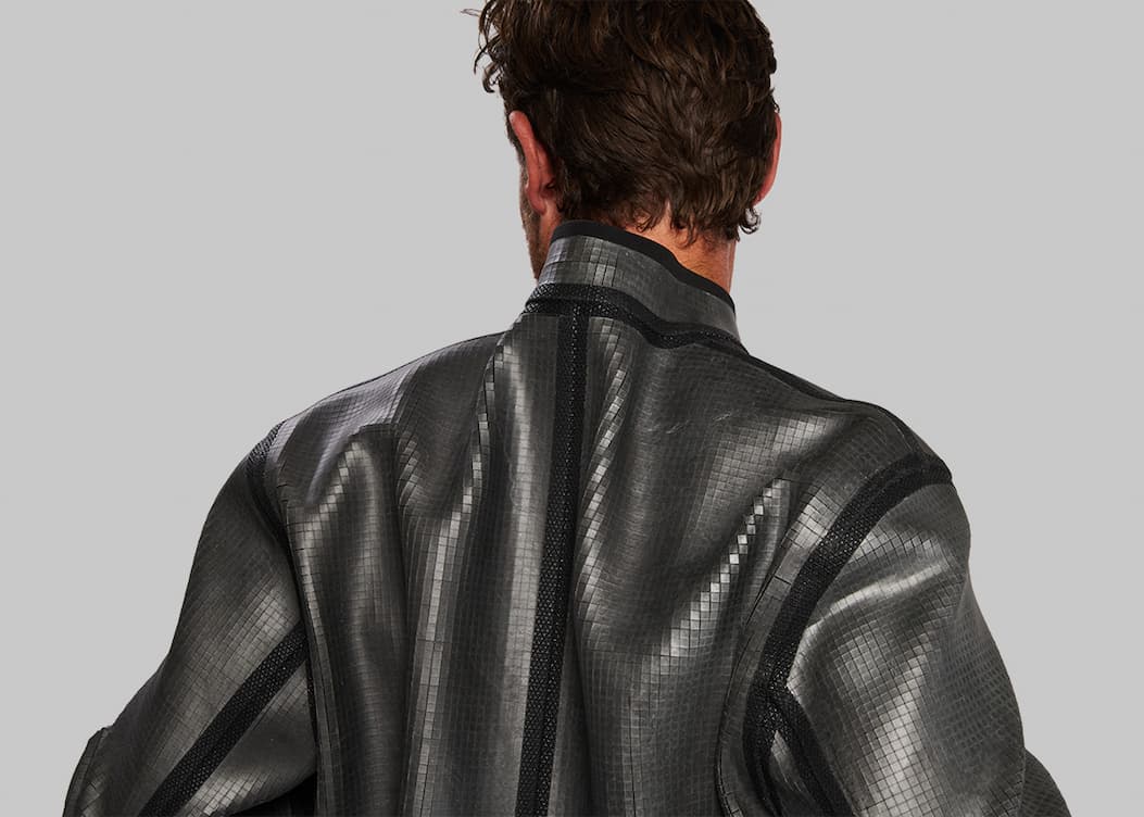
Leprizé’s material got us part of the way there. But we still had to make it truly wearable. In design terms, the material’s armadillo-like tiles ruled out anything too tightly fitted, so we kept bends, sharp turns and gatherings to a minimum.
We settled on a minimalist and suitably sci-fi cropped Harrington and laser-cut our way through 5 of Leprizé’s slate sheets. Stitching slate was never an option, so the seams are visibly taped. We added Cordura® pockets and a zip.
The Rock Jacket | vollebak.com
The Rock Jacket is a one-off, a proof of concept. We’re not pretending it’s practical. Not this version anyway. But as with the Wooden Jacket, scalability and day-to-day wearability are the ultimate ambition.In an era when fashion is barely worn before it’s thrown away, our jacket is a piece of Earth’s crust that took millions of years to form. It’s absurd armour and cold, hard couture. And it asks us to rethink our relationship with the oldest materials we have.
 For the Silo, NICK AND STEVE TIDBALL – FOUNDERS Vollebak

Urbanization Of Rural Farm Land Threatens Archaeological Evidence

The Haldimand-Norfolk Archaeological Research Project was a regional study meant to discover new information about the past that has impacted the region such as; glaciers, climate change, prehistoric and historic settlements, wildlife, and geologic formations. 

The agricultural lands of Norfolk and Haldimand County combined is approximately 2,286.49 km2 and is identified as a zone of geologic, archaeological, and historical significance, promising to reveal a great deal about past environmental events and people.

Yet, the urbanization of agricultural lands continues to alter the landscape by removing evidence of forests, tributaries, reduced land elevations, current and past ecologies, and lastly, evidence that people and their descendants once crossed the landscape of this region.  For these reasons a regional study was initiated before this information is lost forever.

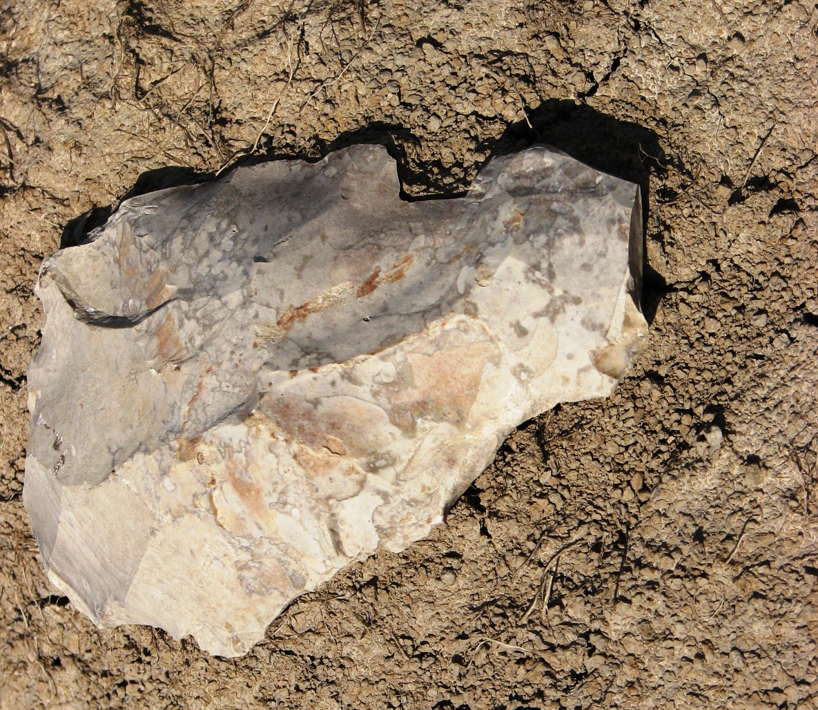
A stone tool retrieved by J. Barker at one of the site surveys.


When you take a closer look at the landscape you can find physical evidence proving that this region is unique. 

Evidence such as the scrapes and grooves on bedrock surfaces by glaciers, erratics and drumlins left behind when glaciers melted away.

Watersheds and their tributaries, originally a result of glacial melt water, continue to drain seasonal waters from the agricultural lands year round.  Present day Carolinian forests represent evidence of climatic changes in the great lakes region that supported a successful transition from a tundra-like environment over 10,000 years ago. 

Mega mammals such as mastodon once roamed the ecosystems of Southern Ontario only to disappear and be replaced by other mammal species.

Geologic formations date back over 80 million years ago where fossils of coral reefs can be found and chert formations were formed and found across Haldimand County.  People identified as Paleo-Indians used these same chert formations over 8,000 years ago to make stone tools as they crossed the landscape.

Regional studies were long-term and paid special attention to all aspects of a changing environment and landscape from one region compared to another.  Typically, a regional study combines different scientific disciplines (e.g., archaeology, geology, hydrology, and paleobotany) that can bring specialists to assist with the recovery of new information.   The results of a scientific study can produce new and unexpected insights into how the environment within a landscape once looked and how it was used by people.

Studies such as this create opportunities for community heritage to improve public awareness and education to understand how long term changes (e.g., climate, urbanization, and development) that can have an impact on a region.

What can a land owner expect when someone comes to their farm as part of a regional study? 

Permission is always asked to begin a study of the landscape on private property. For example, I always work independently, and if help is needed, permission is asked to bring an assistant along.  Once permission is given the study begins by walking over land repeatedly over a period of time and preferably free of crops.

Walking over open fields creates opportunities to examine the topography of the landscape, tributaries, plant and tree life, natural drainages, tree growth, and land elevations.  Observations of prehistoric camps or historical homesteads, and their refuse pits is recorded when found. 

Evidence of a camp or homesteads where people lived is called settlement patterns. 

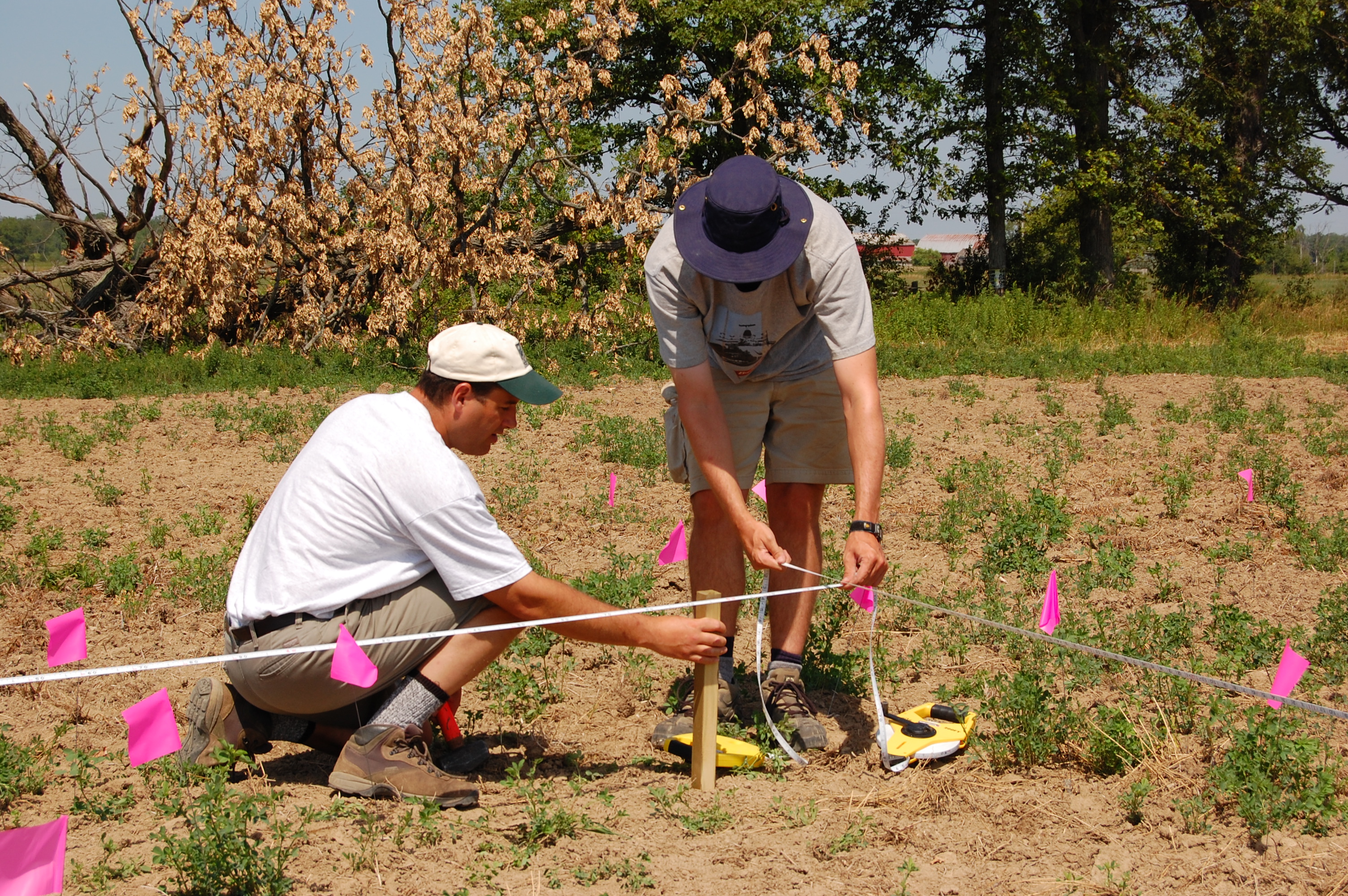
When settlement patterns are observed Geographic Positioning System coordinates are collected to record the exact location.  Even though archaeological excavations are sometimes necessary, they are restricted to a small area.  No excavation activity takes place unless permission is given by the landowner.

Even then, the landowner is first shown where an excavation is proposed on their property, and if crops are on the land, there is an offer of crop damage compensation based on current markets prices for wheat, soy, and corn.

A standard practice for a regional study is to recover and record the location of artifacts (e.g., prehistoric or historic) observed on the ground. These are recovered to gain new scientific insights regarding their origin, exact age, context, and association to surrounding landscapes.  This includes the recovery of samples from rock formations for geologic studies.

Since regional studies are focused on private lands, all information is kept confidential and private.  Information is not shared with the general public at any level, and there is absolutely no interference with farming practices whatsoever.  Its business as usual!  If landowners are curious to know what I am learning about the region from studying their farm land I am happy to share this information. For the Silo, Lorenz Bruechert/ Jarrod Barker. 

The Fuss About Archaeology Conducted On Ontario Farmlands

Farmland development throughout wind-powered Ontario has resulted in the hiring of many consulting archaeologists by developers of solar panels and wind turbine farms and the public continues to wonder why so much attention is given to archaeological sites several thousand years old that hold little or no cultural value to the people who live there today. One reason is simple to explain: developers closely follow the laws of the Ontario Heritage Act, which promotes the protection, and conservation of heritage sites before and after European Contact and therefore are bound to archaeology. The Heritage Act came into force in 1975 as a way to protect archaeological sites. Even architectural structures built over a century ago come under the protection of the Heritage act if deemed of historical significance.

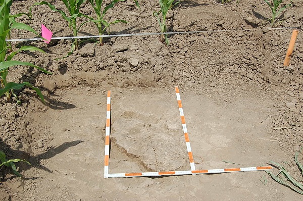
This photo shows a ‘feature’- where stone flakes were recovered from a flintknapping moment about 7,000 years ago.

But other than the legal issues, what is all the fuss about these archaeological sites in Ontario rural municipalities? Well, a lot has to do with how little the public knows about the earliest people who began to inhabit the Great Lakes region over 10,000 years ago. Increased development has resulted in many archaeological sites being uncovered, which helps to answer questions such as: who were these early people? How did they survive? [Especially during a time of mammoths and glaciers CP] Where did they come from? How were they impacted by climatic changes? How long did they live on the landscape before being replaced by other groups of people? Which leads to another, penultimate question: How can these questions be answered?

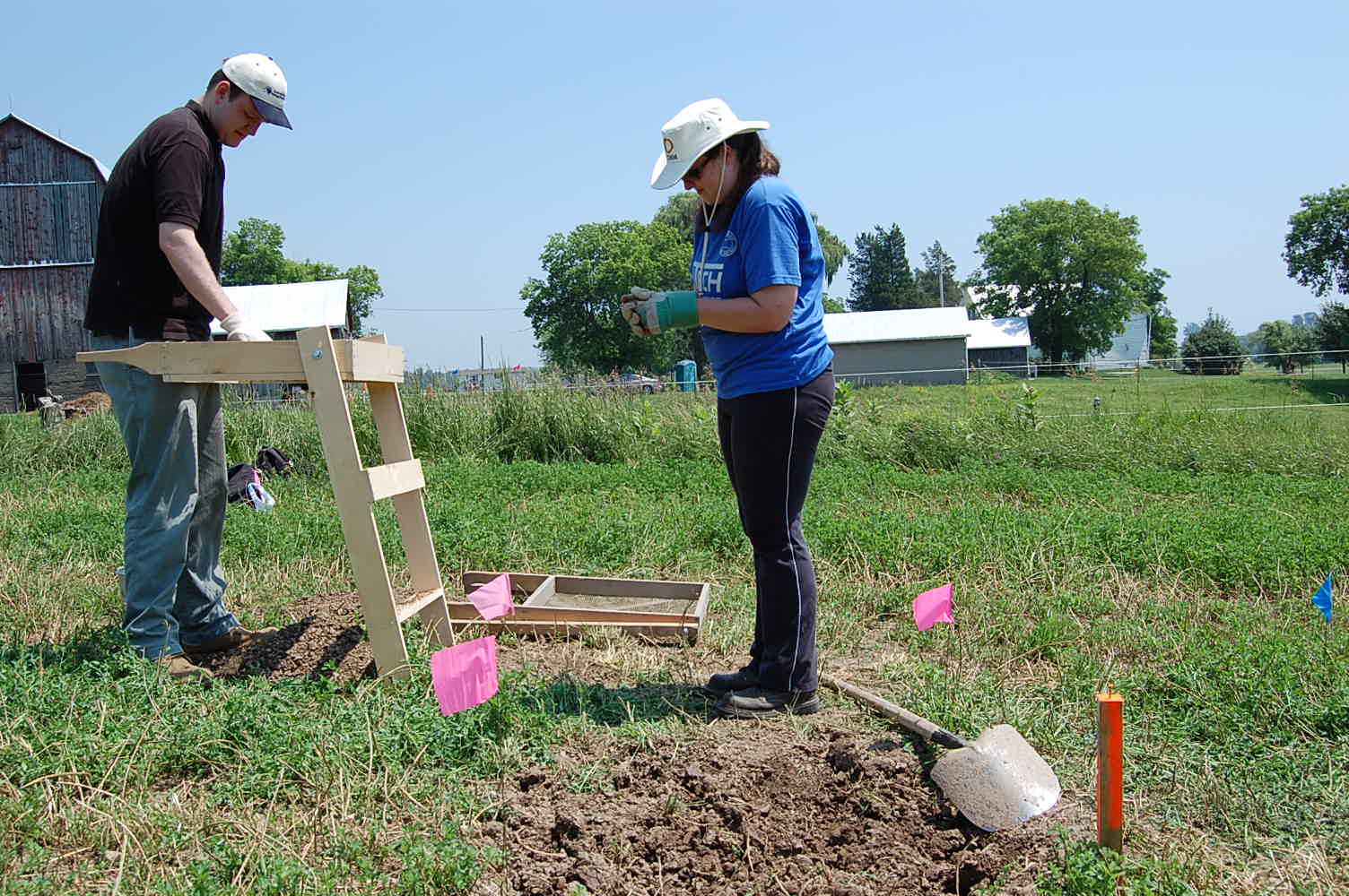
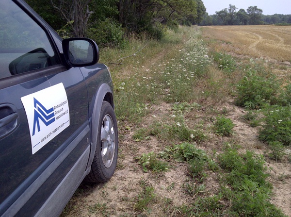
Complying with the Heritage Act- solar and wind power developers are hiring more and more consultant archaeology firms to conduct studies of Ontario farmland. This picture taken on July 17, 2012 at an area East of Nanticoke, Ontario. photo: The Silo

Here is one way. Archaeologists working on a site discovered a location where an ancient person was breaking stone into smaller pieces for making stones tools. Archaeologists found a location below the ground surface where pieces of stone fell and remained for over 7,000 years. One of the first questions archaeologists tried to answer is was that person standing or sitting down at that particular location when they dropped the pieces of stone.

The best way to answer that question was to do “experimental archaeology”. In this case, stone tools left in a forest are observed to determine how natural processes move and cover artifacts over time. Some stone tools are ‘dropped’ or left while standing and others while sitting down on a log or other structure. The difference in posture and stance and the difference in the height of the drop affect the way the pieces of stone fall, land and how they orient themselves on the ground.

Click to view on I-tunes

This affects the way that they are weathered, covered and deposited. After a long period of experimenting and observation, it was determined that a person likely sat on a log while making their stone tools. The broken flakes of stone, covered and protected by forest debris, resulted in a well-preserved location where someone once sat down to made stone tools.
So the next time you come across a scatter of broken stone try to imagine who sat there as they made their stone tools and what the land once looked like long ago. For the Silo, Lorenz Bruechert. /Jarrod Barker.